Log in
All resources
Create a design
11,660 Free Images of Old Map
maps made in the 17th century
maps by pieter schenk (i)
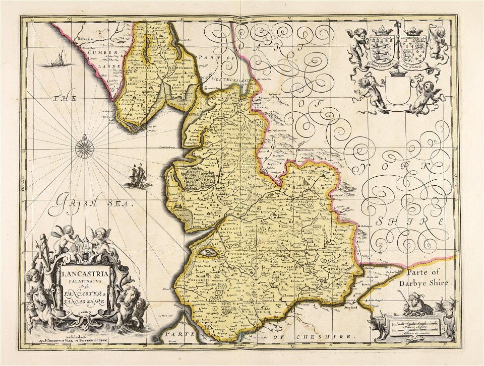
gerard valck
atlantis magni tomus secundus (biblioteca comunale di trento)
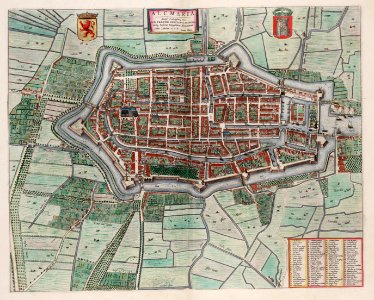
braun & hogenberg
geographical illustrations by coronelli
atlantis magni tomus tertius (biblioteca comunale di trento)
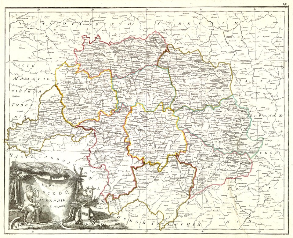
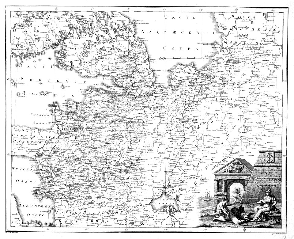
atlas of the russian empire (1800)
atlas of the russian empire (1792)
maps with cartouches
atlas of the russian empire (1800)
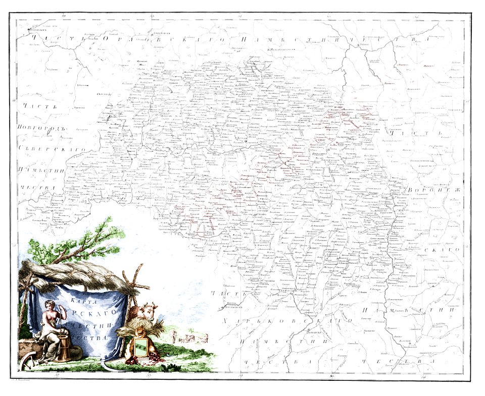
old maps of kursk governorate
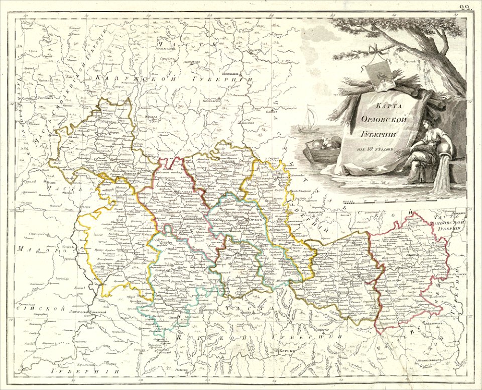
atlas of the russian empire (1800)
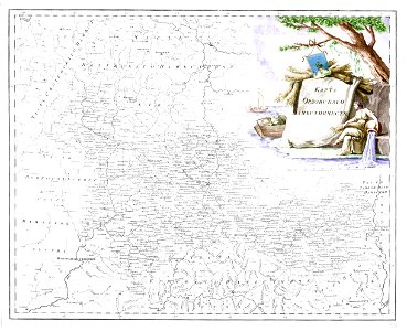
old maps of oryol governorate
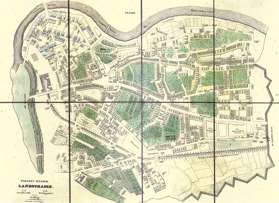
old maps of landstraße (vienna)
carl graf vasquez
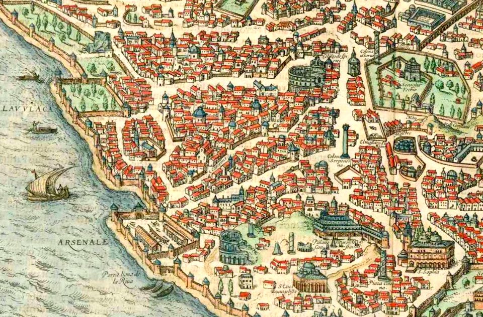
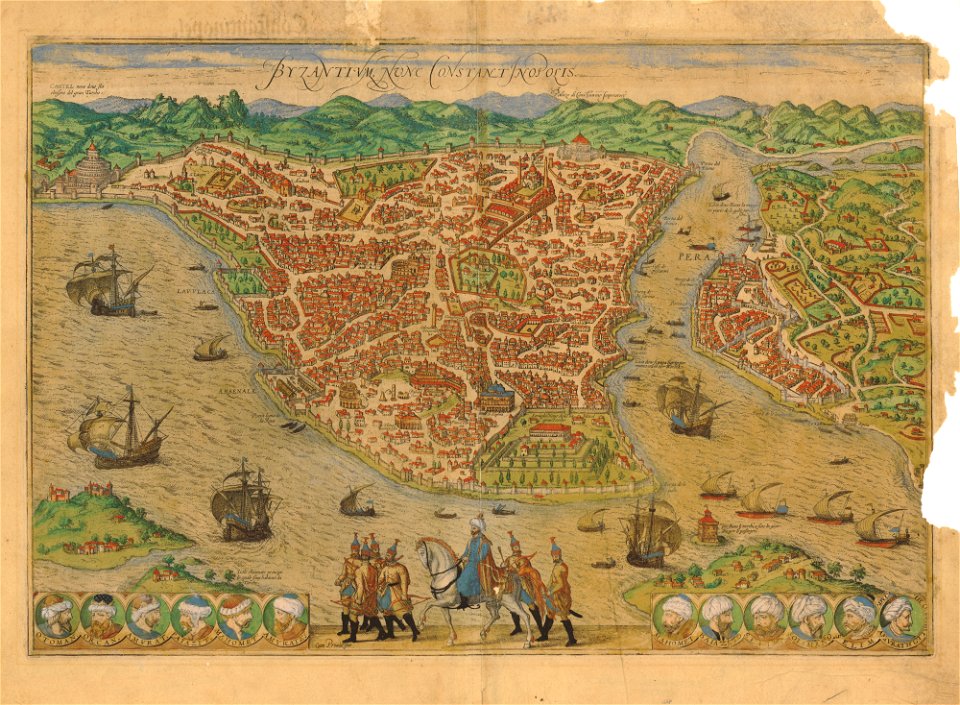
old maps of constantinople
braun & hogenberg
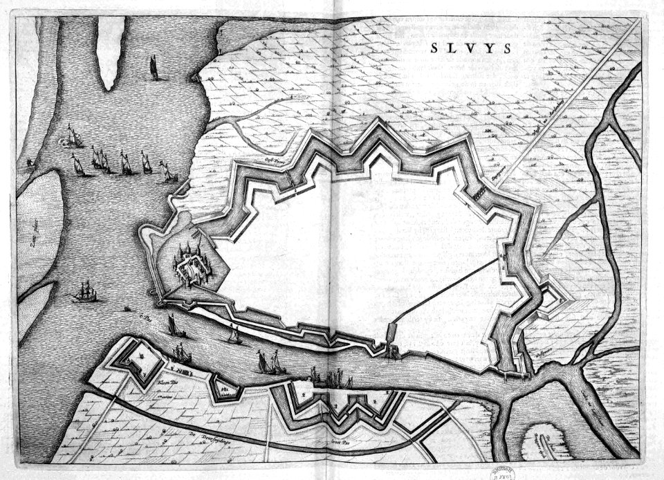
old maps of sluis
atlas beudeker
braun & hogenberg
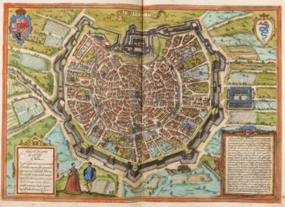
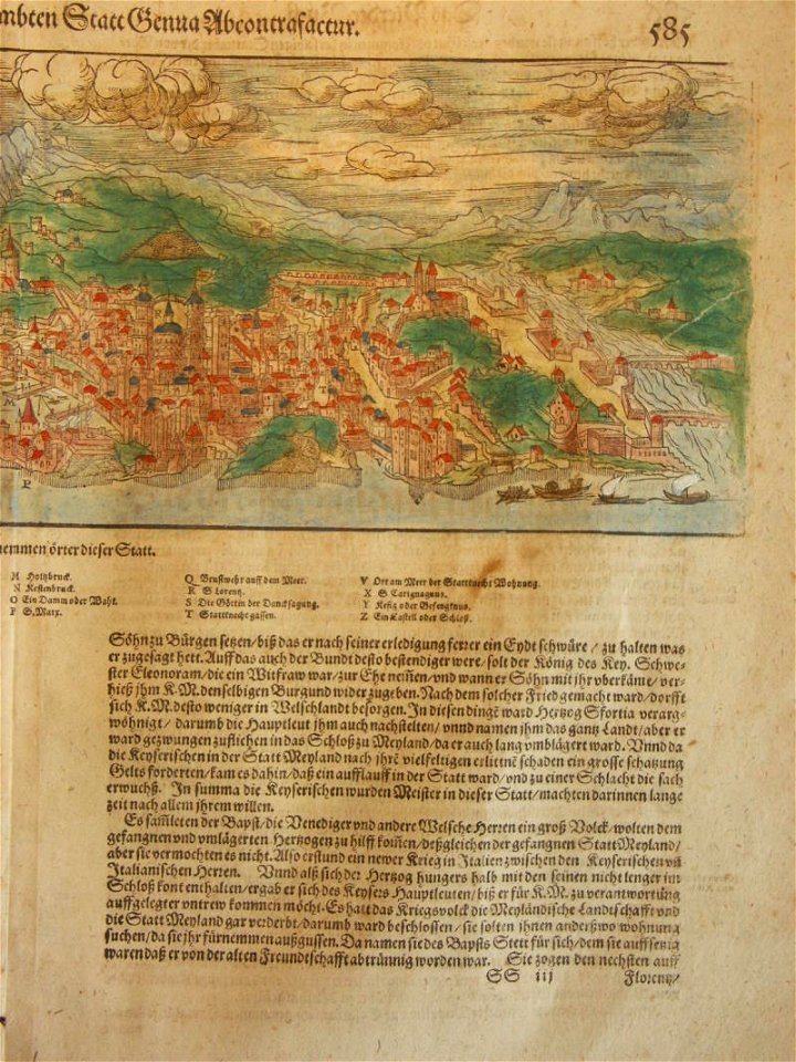
old maps of milan
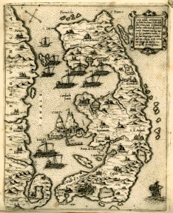
old maps of cyprus
giovanni camocio
geographical illustrations by coronelli
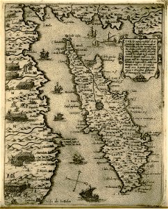
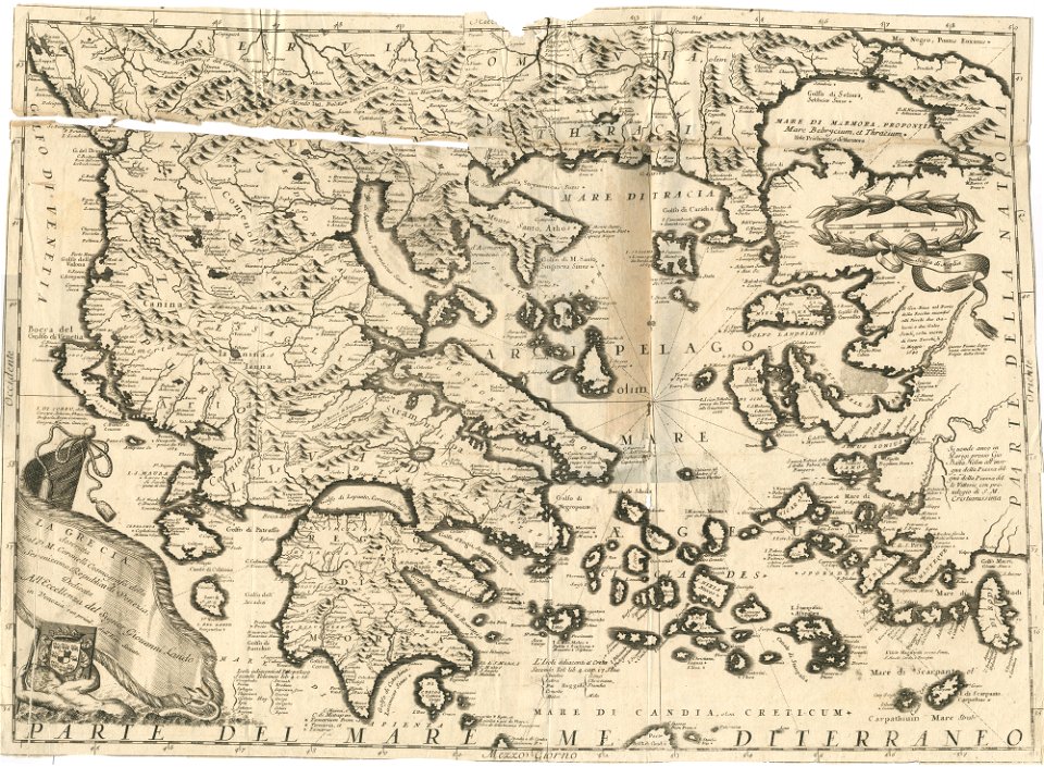
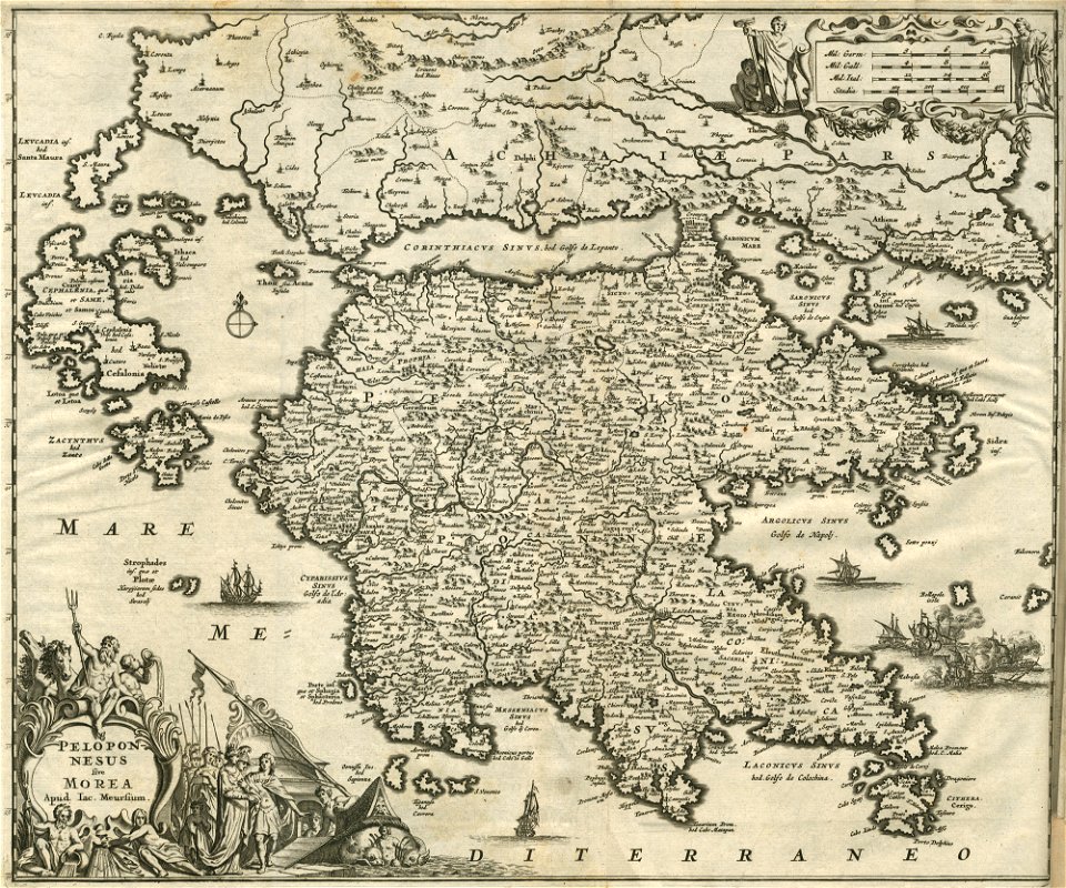
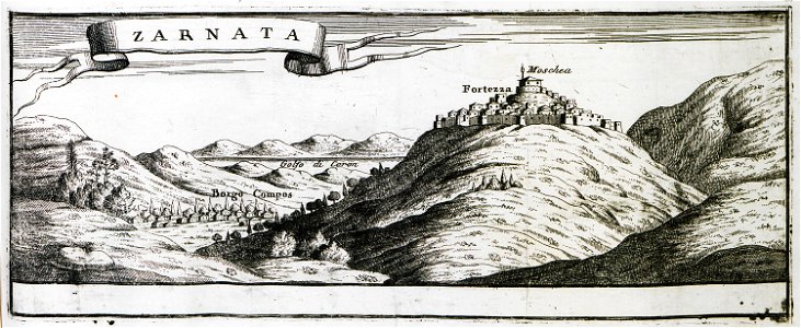
old maps of the peloponnese
atlas of the russian empire (1792)
old maps of kursk governorate
engravings of topographia bohemiae moraviae et silesiae
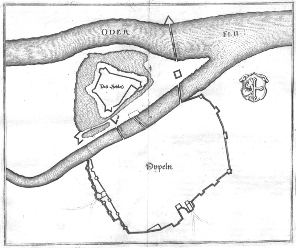
old maps of opole
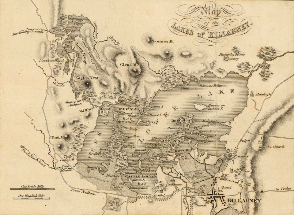
old map
pirate
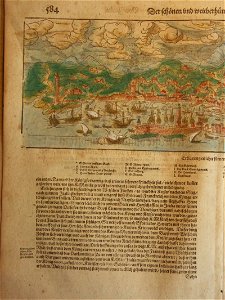
cosmographia (1600) by sebastian münster
old maps of florence
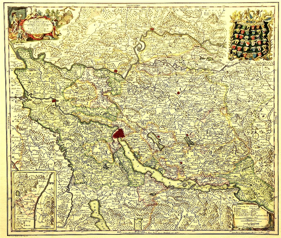
delineatio pagi tigurini by matthäus seutter
old maps of switzerland
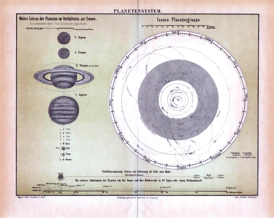
world
maps
ardennes (belgium)
gallia belgica
map images supported by wikimedia uk
1856 maps
antique
maps
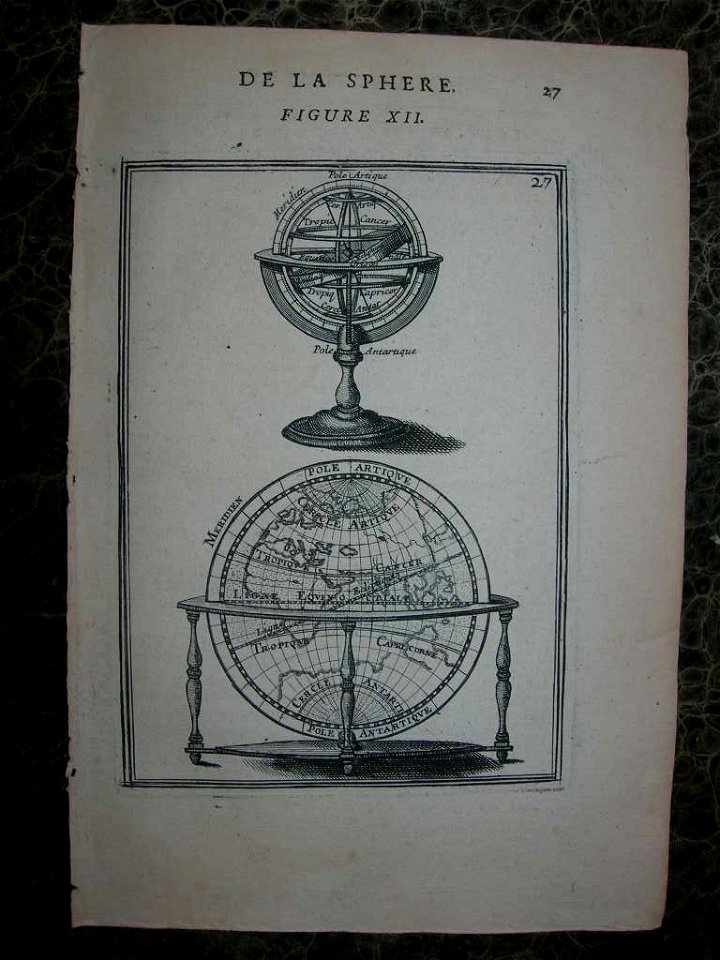
old celestial maps
atlas of the russian empire (1792)
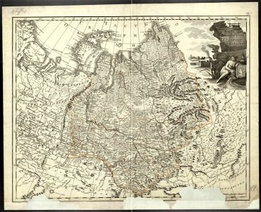
old maps of tobolsk governorate
edi expedition
aceh war
old maps of alkmaar
atlas van loon
old maps of corfu
giovanni camocio
netherlands in the 1660s
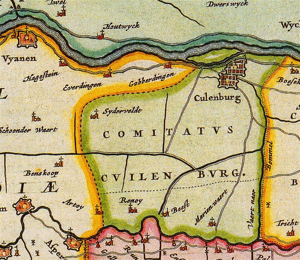
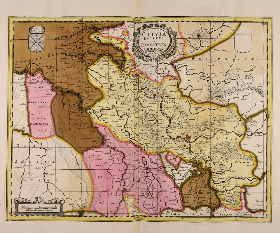
old maps of gelderland
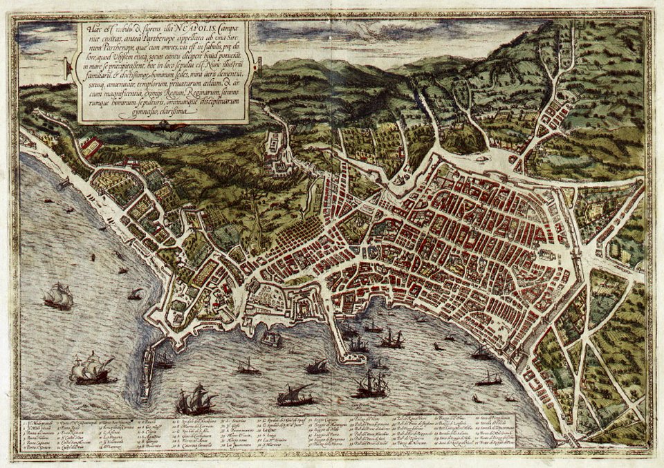
old maps of naples
braun & hogenberg
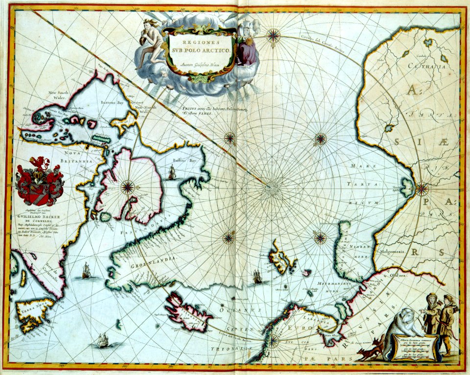
the northern hemisphere of the celestial globe by albrecht dürer
old celestial maps
atlas of the russian empire (1792)
old maps of oryol governorate
atlas of the russian empire (1800)
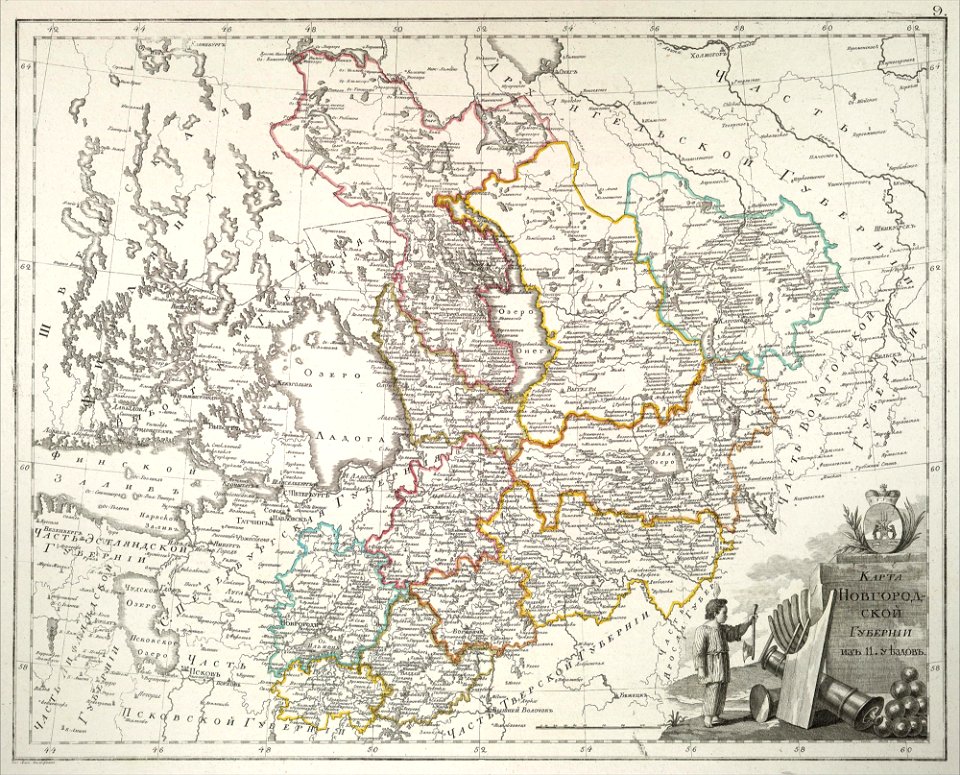
old maps of novgorod governorate
atlas of the russian empire (1800)
old maps of tobolsk governorate
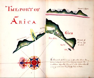
la serena
chile
geographical illustrations by coronelli
old maps of greece
maps with cartouches
atlas van der hagen
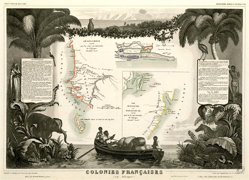
victor levasseur - maps of the world
old maps of senegal
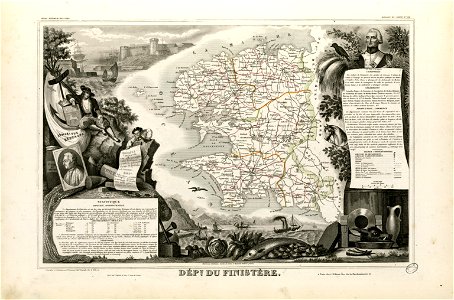
coats of arms of cities in finistère
axes in art
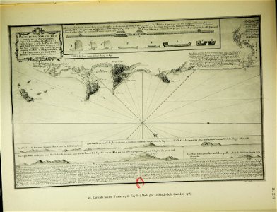
old maps of the sea of azov
1856 maps
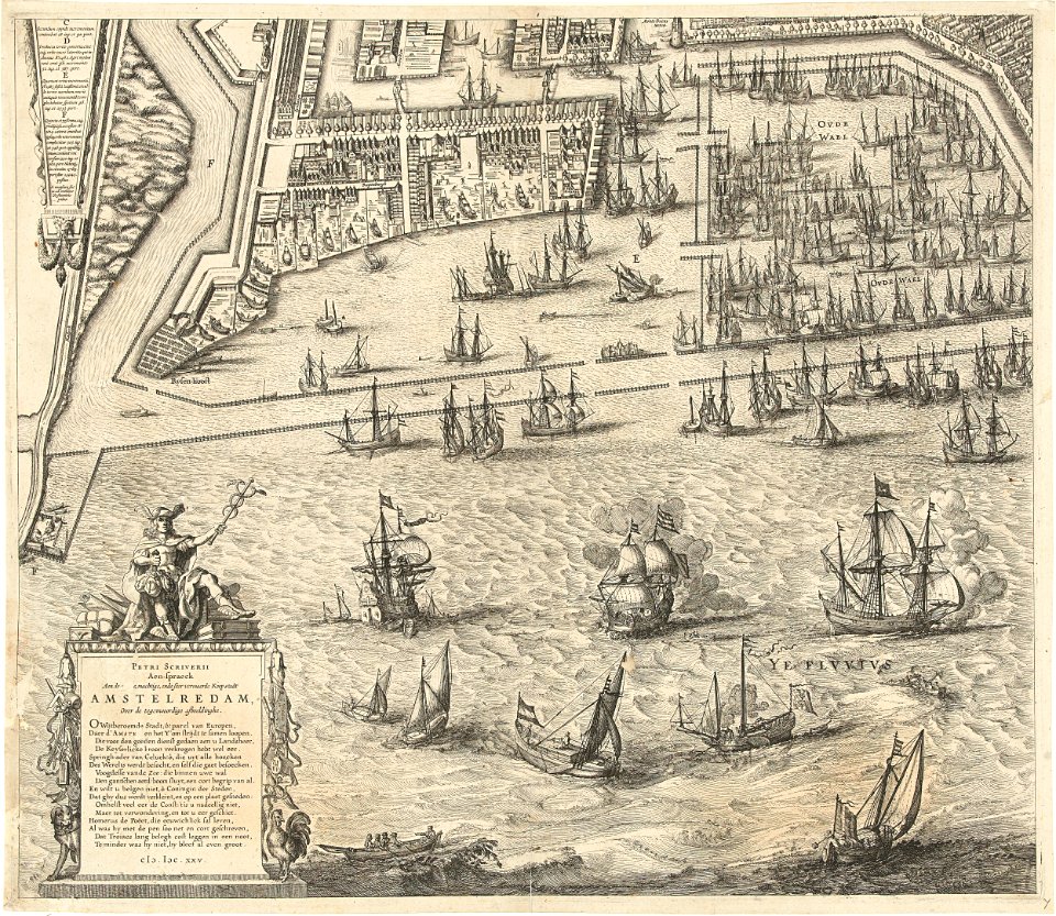
dutch 17th-century prints in the rijksmuseum amsterdam
petrus scriverius
copper engraving
1645 maps
old maps of the dutch east india company
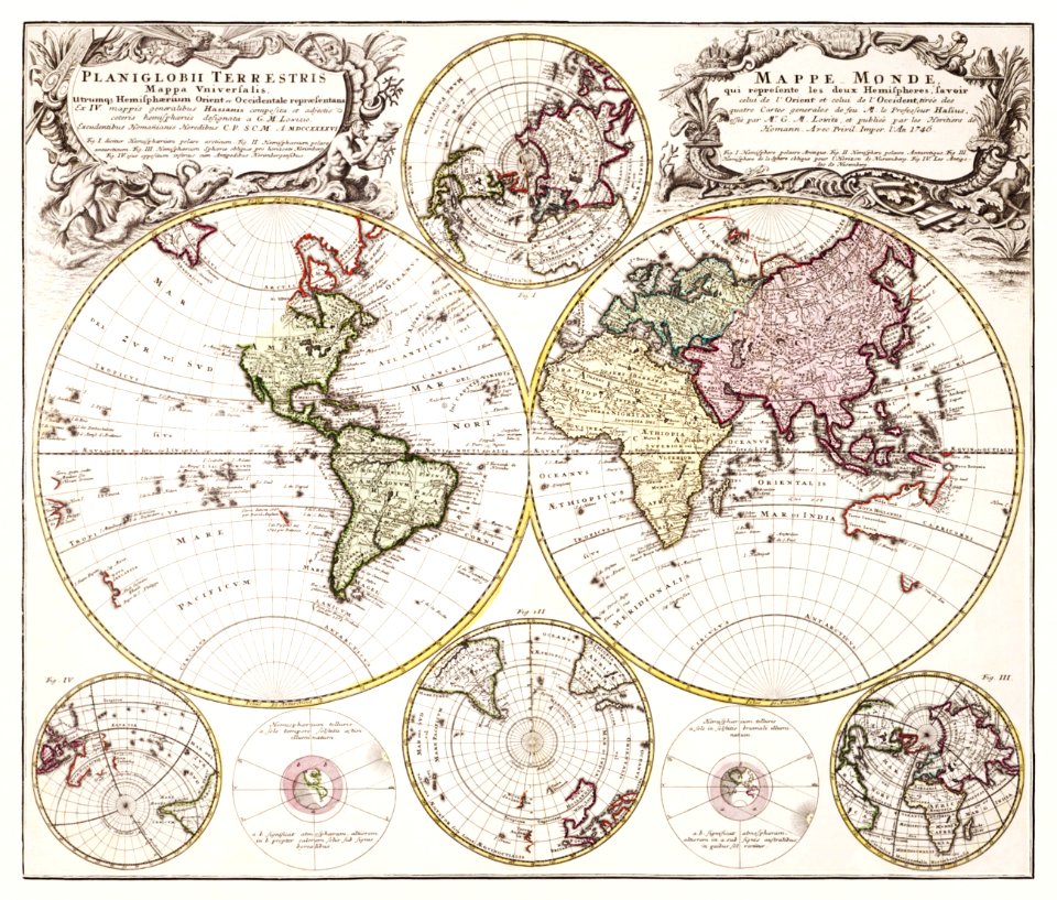
1747)
gerard valck
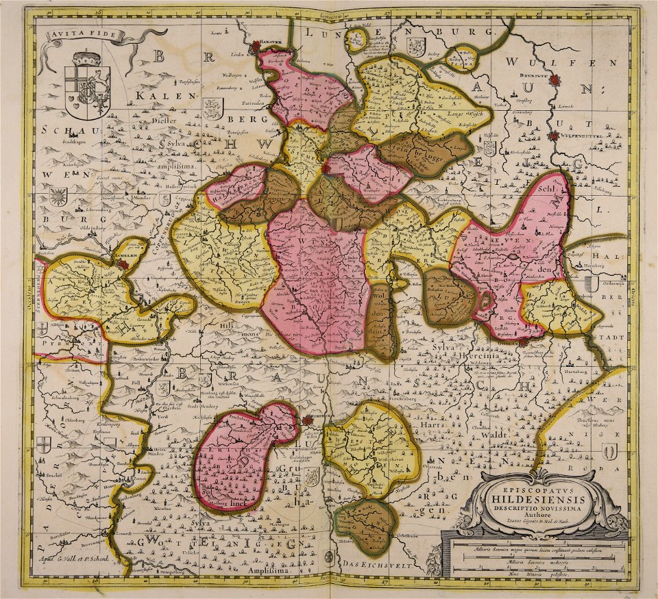
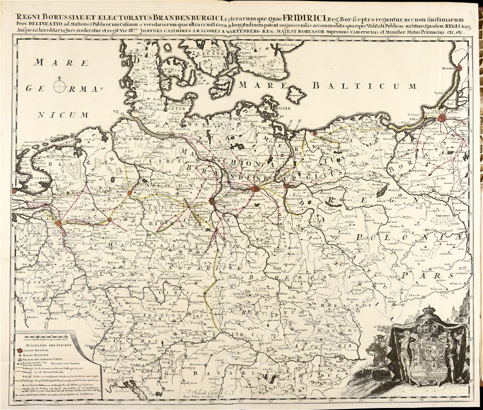
germany
maps made in the 17th century
gerard valck
broad street
reading
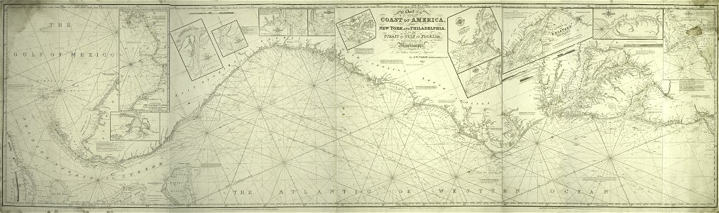
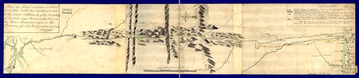
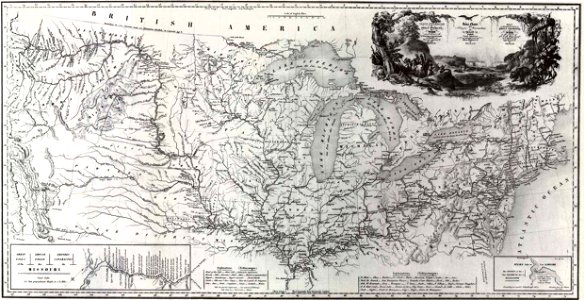
maps in the library of congress
old maps of maine
fonds ancely - bibliothèque municipale de toulouse - maps
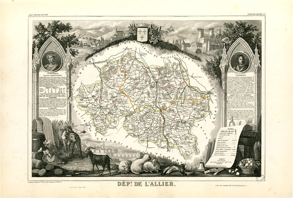
coats of arms of cities in allier
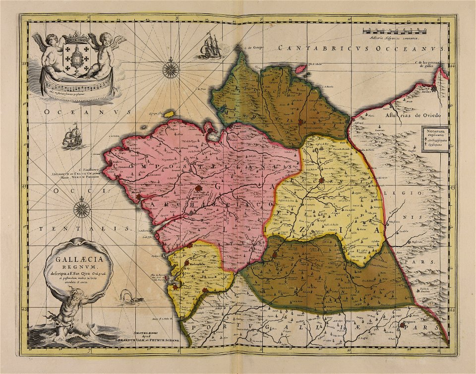
maps made in the 17th century
gerard valck
maps made in the 17th century
gerard valck
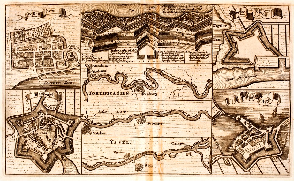
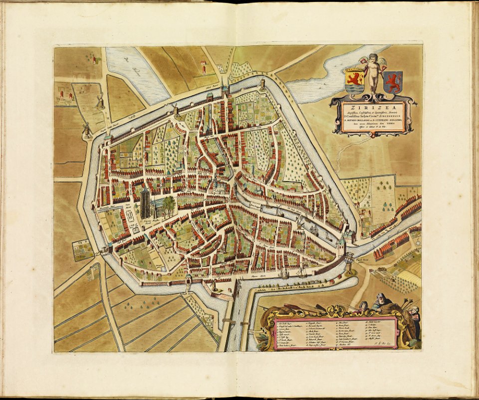
fortifications in the netherlands
zwartsluis
old maps of greece
olfert dapper
old maps of istanbul
braun & hogenberg
geographical illustrations by coronelli
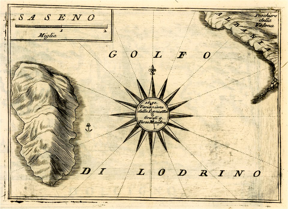
sazan
old maps of saint petersburg governorate
atlas of the russian empire (1792)
schauplatz der fünf theile der welt
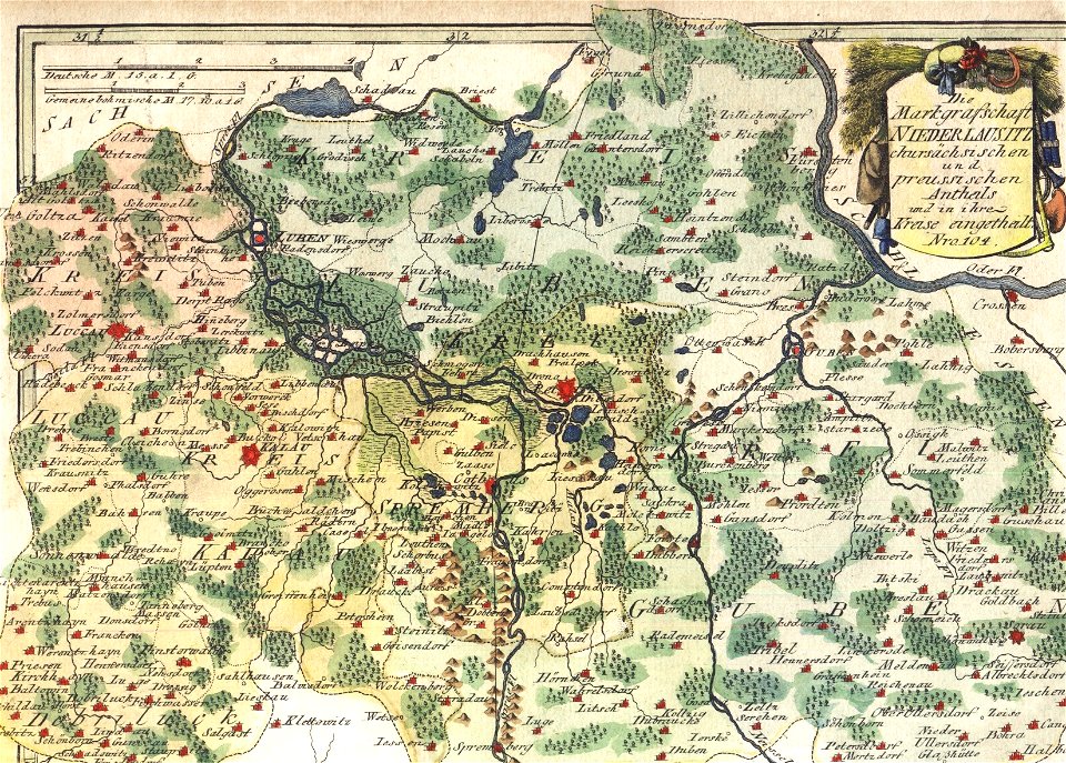
old maps of lusatia
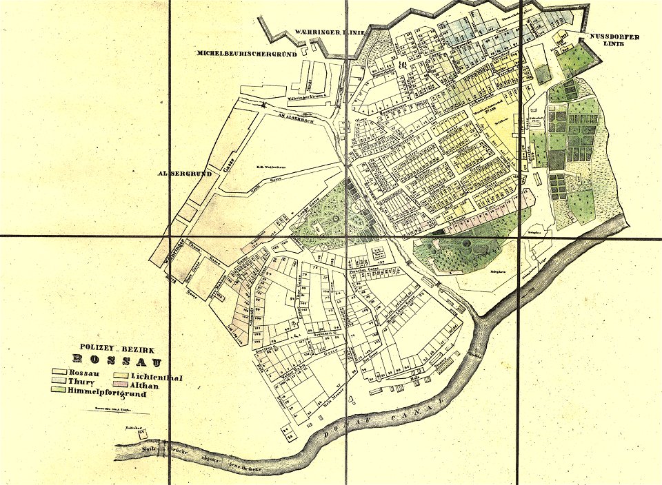
old maps of alsergrund
carl graf vasquez
geographical illustrations by coronelli
old maps of the peloponnese
description de l'universe
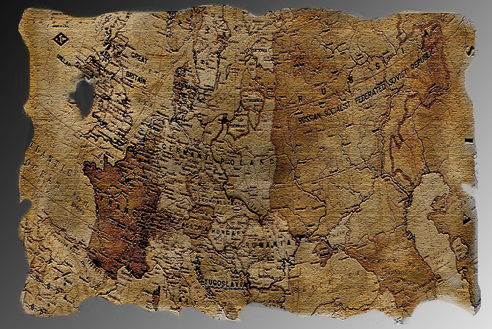
old maps of the world
cosmographia (1600) by sebastian münster
old maps of florence
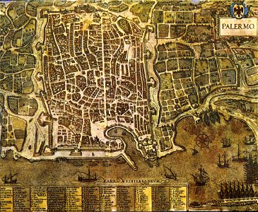
palermo
1581
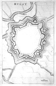
old maps of hulst
atlas beudeker
old maps of szczecin
frans hogenberg
geographical illustrations by coronelli
old maps of the peloponnese
christian gottfried heinrich geißler
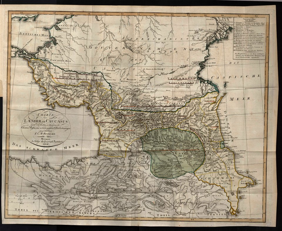
19th-century maps of the caucasus
ocean
maps
maps by frederick de wit
trier see coat of arms
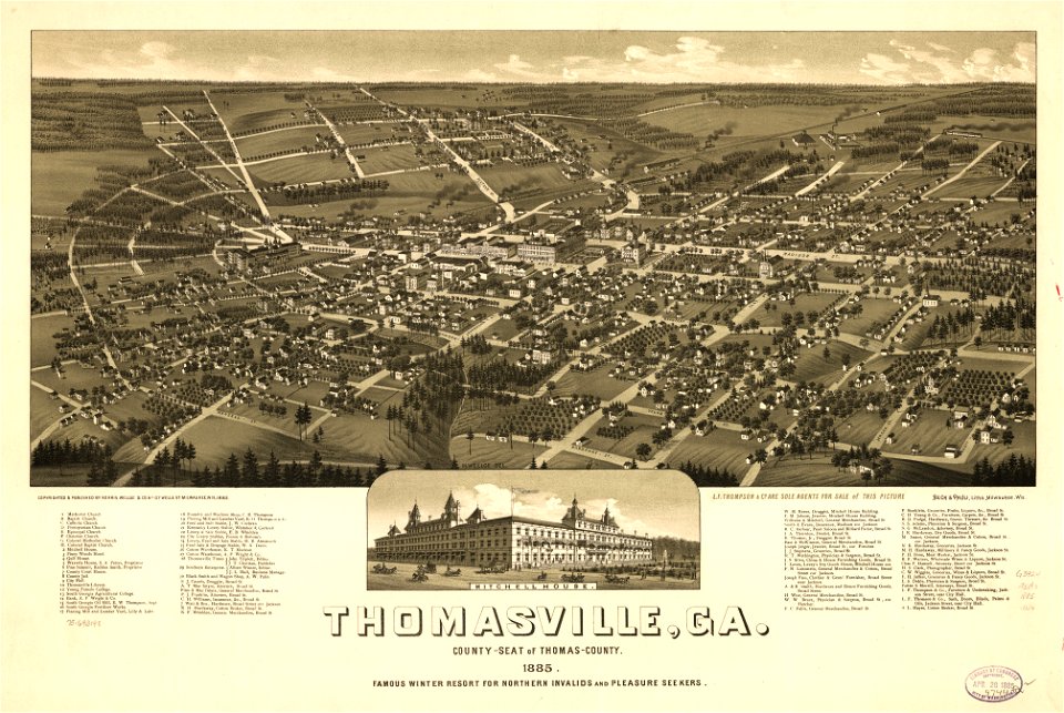
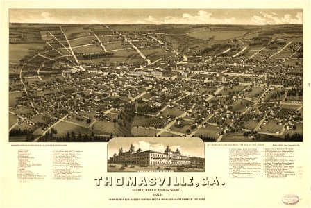
thomasville
georgia
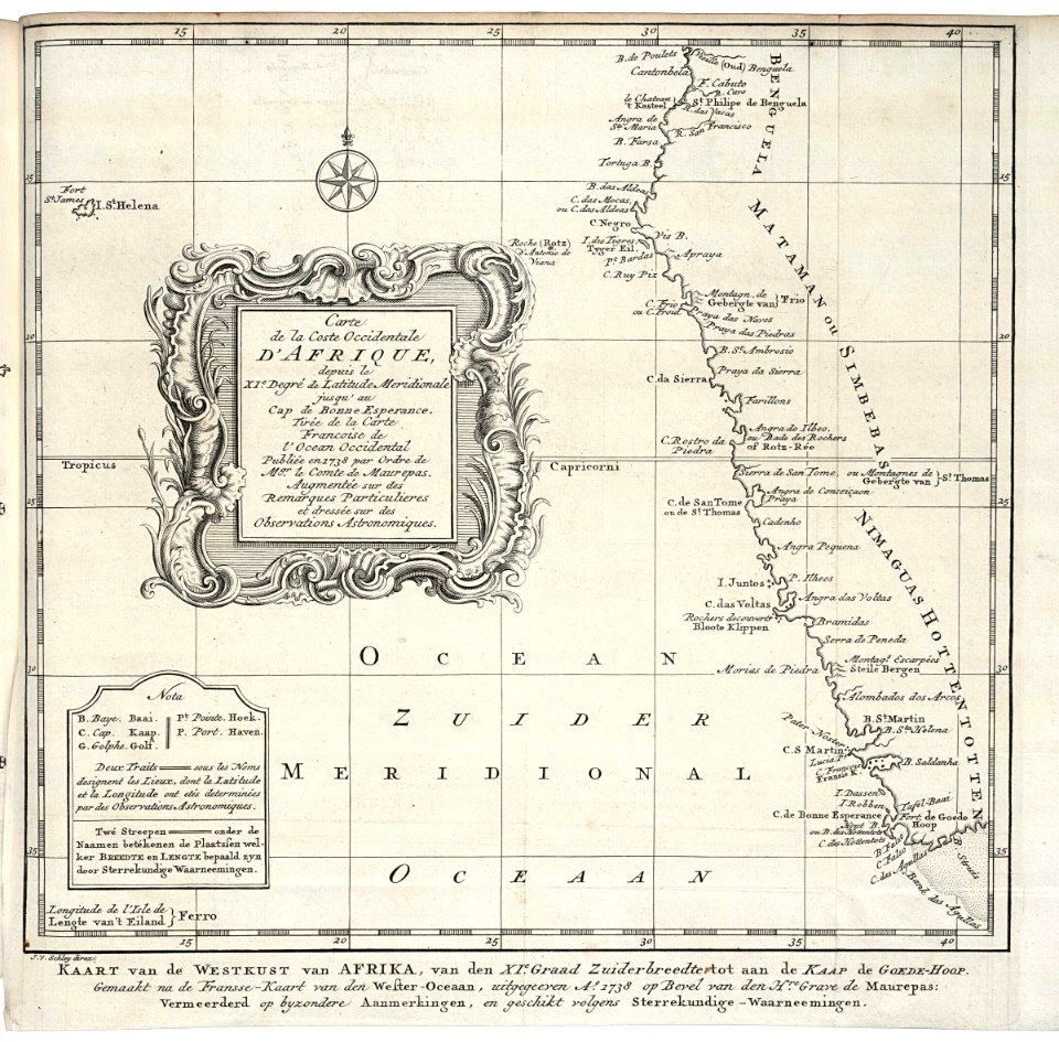
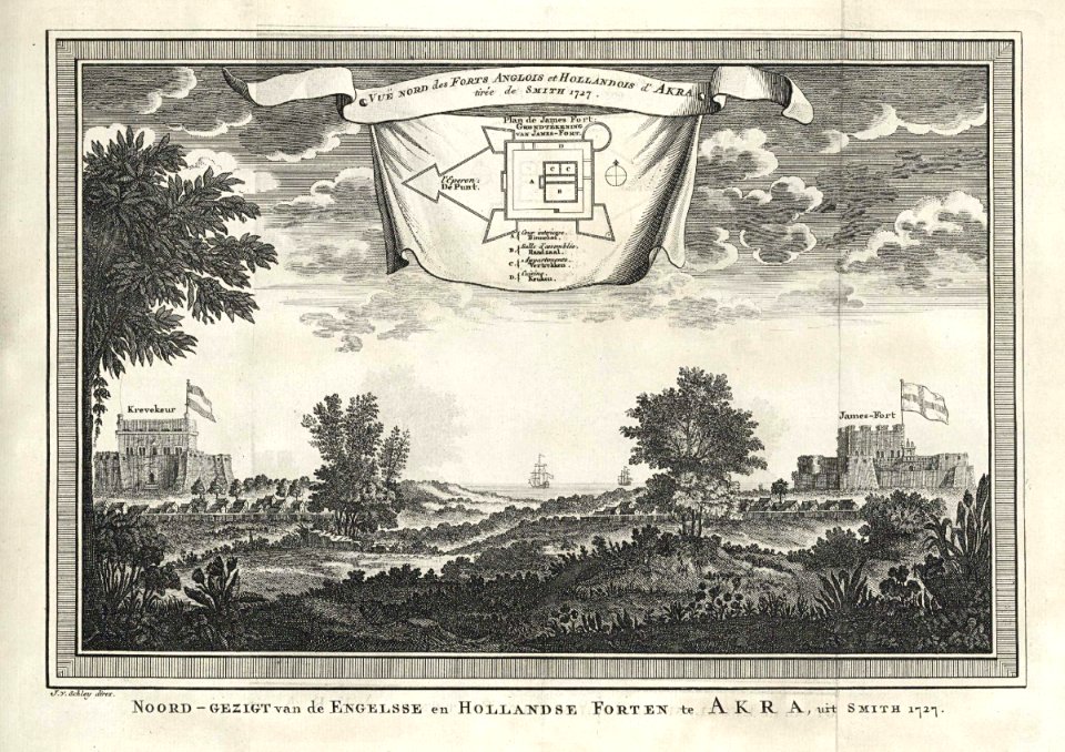
old maps of the dutch east india company - africa
johannes van keulen
maps with cartouches
atlas van der hagen
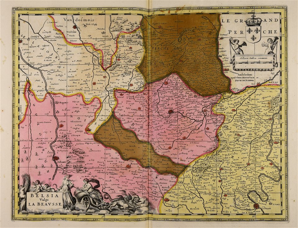
maps made in the 17th century
gerard valck
maps made in the 17th century
gerard valck
maps made in the 17th century
gerard valck
maps made in the 17th century
gerard valck
maps made in the 17th century
old maps of skåne
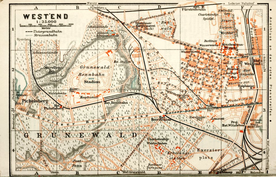
wagner & debes
1914 in berlin
maps of the west-indische compagnie
1745
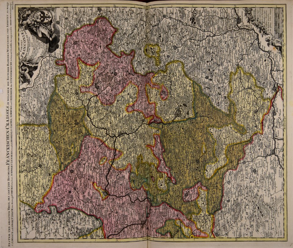
collections of staatsbibliothek bamberg
franconian switzerland
images uploaded as part of nlw - wmuk collaboration
cc-zero
1887 in bretagne
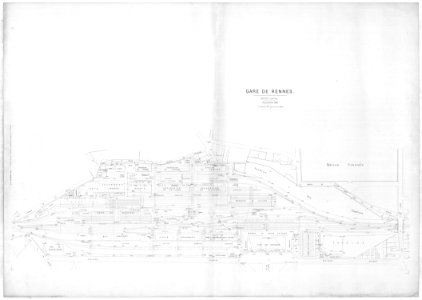
gare de rennes
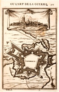
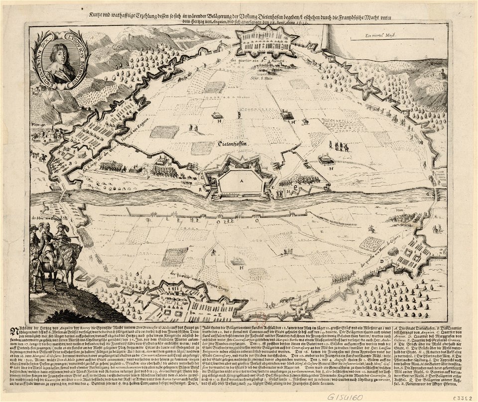
old maps of landrecies
pentagon
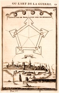
old maps of calais
pentagon
old maps of vietnam
nguyễn lords
maps of thionville city walls
louis
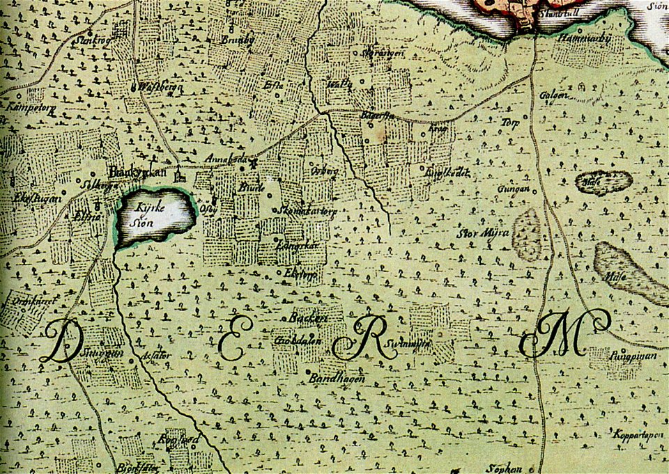
brännkyrka kyrka
älvsjö gård
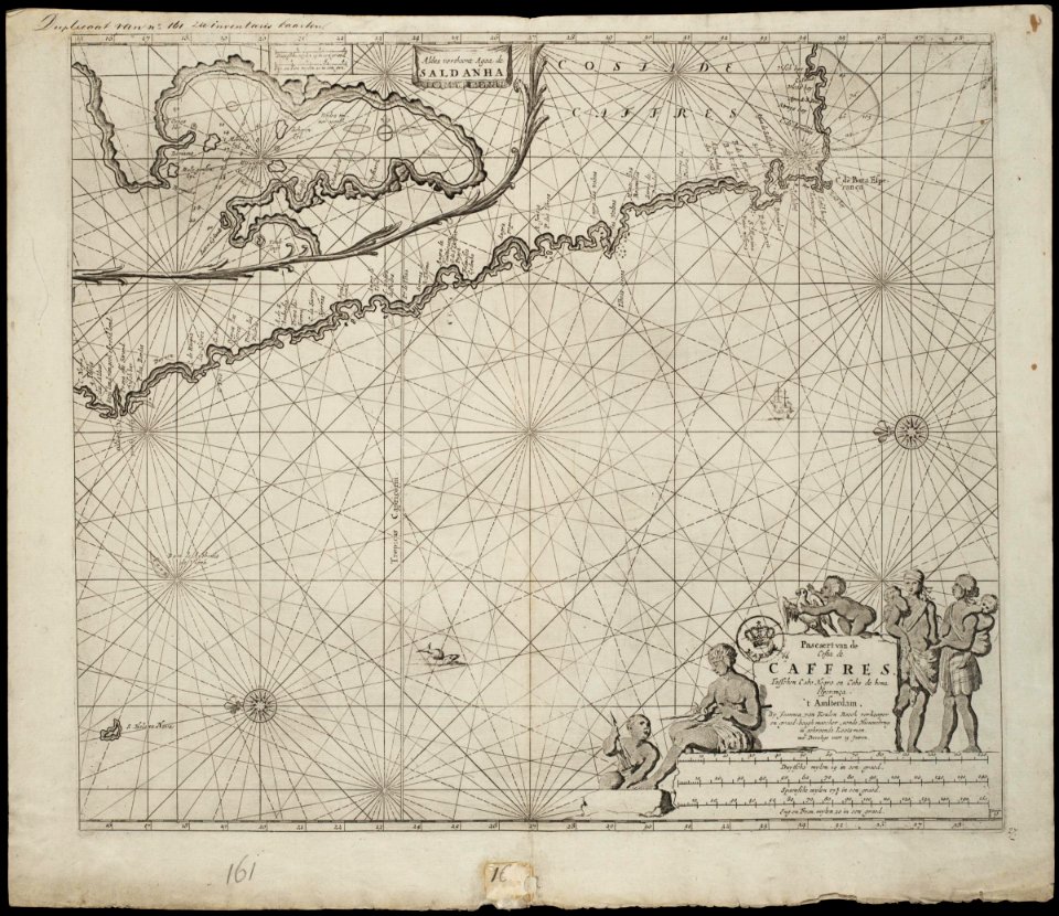
old maps of south africa
boer
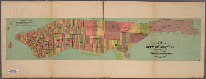
manual of the corporation of the city of new york (1870)
new york city
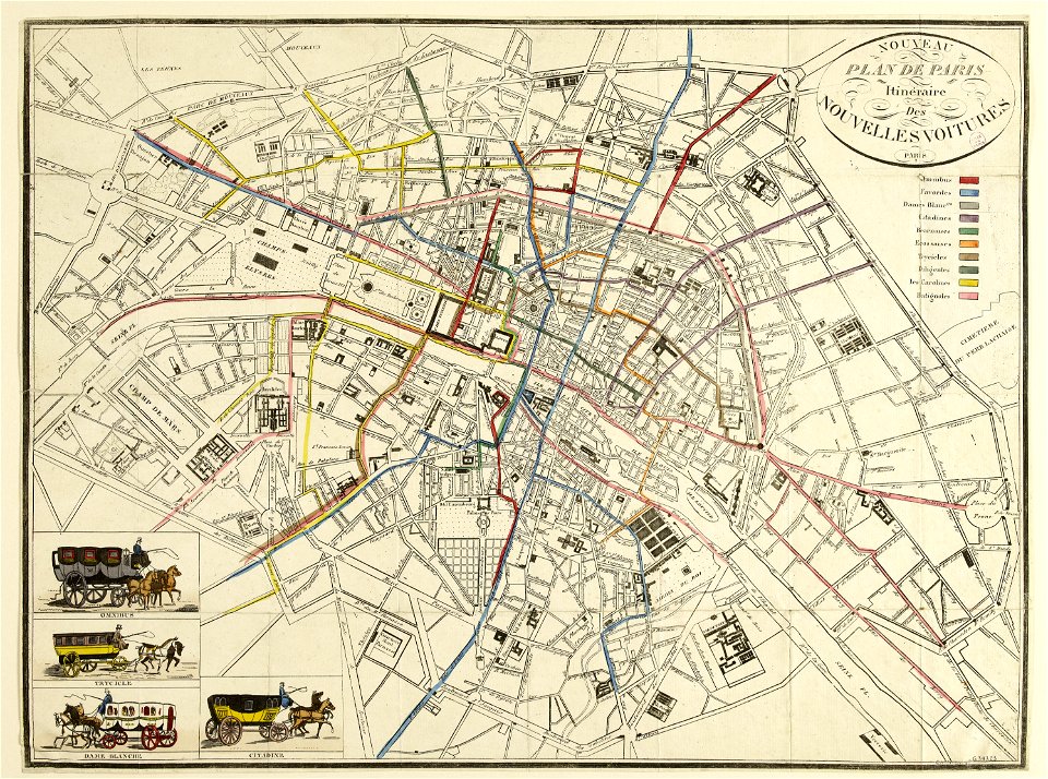
horse-drawn buses in paris
historical buses in paris
coats of arms of breda
netherlands
atlantis magni tomus quintus (biblioteca comunale di trento)
maps made in the 18th century
maps with cartouches
vercelli
maps made in the 17th century
gerard valck
maps in the library of congress
old maps of maine
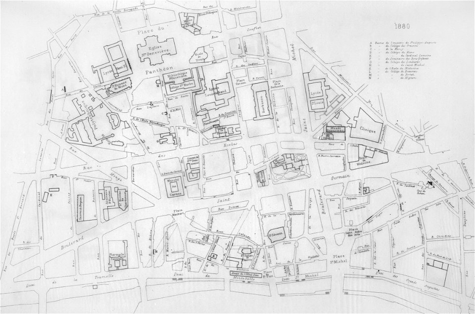
lithographs of paris
université de paris
thomasville
georgia
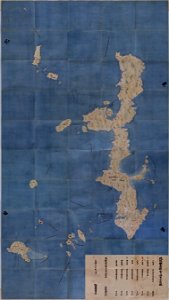
maps in the national archives of japan
genroku kuniezu
maps made in the 17th century
gerard valck
coats of arms of cities in eure
old maps of eure
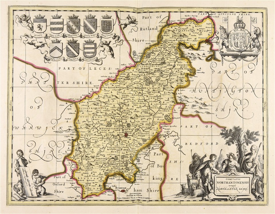
maps made in the 17th century
maps by pieter schenk (i)
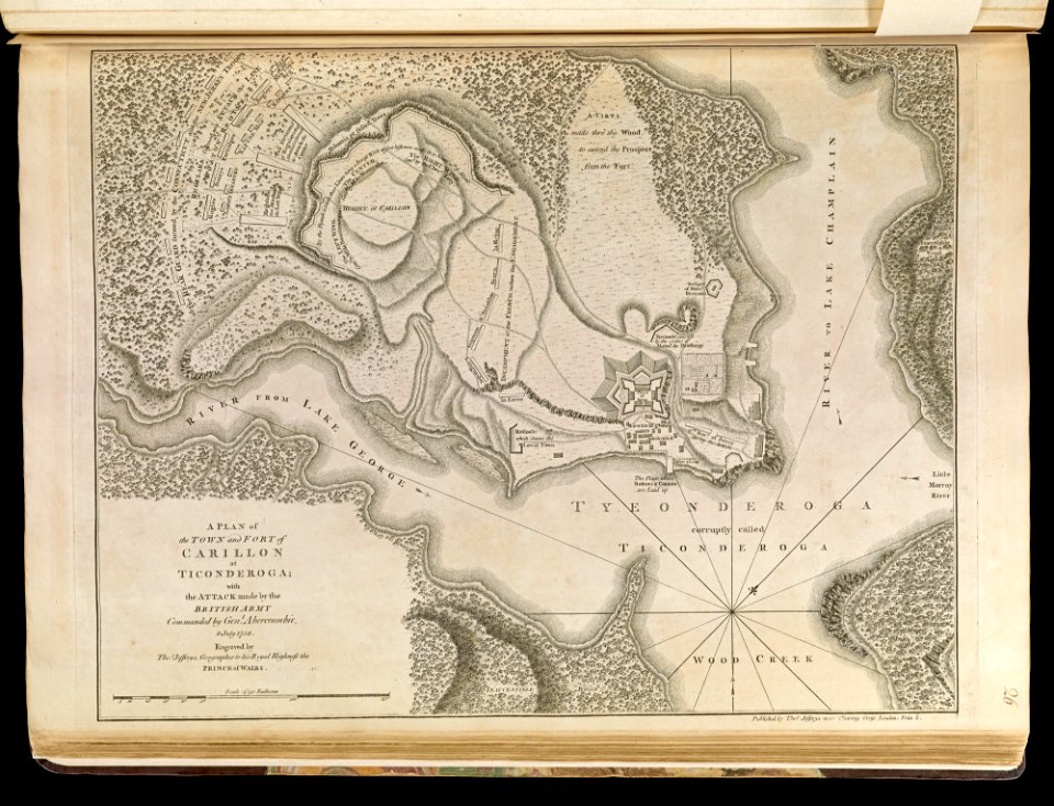
old maps of new york (state)
fort ticonderoga
maps made in the 17th century
gerard valck
maps made in the 18th century
gerard valck
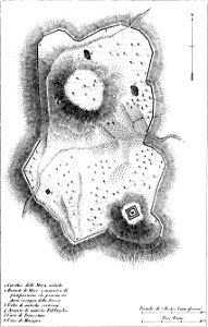
maps of archaeological sites in italy
old maps of tuscany
old maps of north america
1843 maps
maps of the west-indische compagnie
1747)
maps by willem and johannes blaeu
copper engraving
3001 - 3100 of 11,660
Next page
/ 117